Georgetown is the capital of Guyana, located in Region 4, which is also known as the Demerara-Mahaica region. It is the country’s largest urban centre. It is situated on the Atlantic Ocean coast at the mouth of the Demerara River and it was nicknamed ‘Garden City of the Caribbean.’
Georgetown serves primarily as a retail and administrative centre. It also serves as a financial services centre. The city recorded a population of 118,363 in the 2012 census.
The city of Georgetown began as a small town in the 18th century. Originally, the capital of the Demerara-Essequibo colony was located on Borselen Island in the Demerara River under the administration of the Dutch. When the colony was captured by the British in 1781, Lieutenant-Colonel Robert Kingston chose the mouth of the Demerara River for the establishment of a town which was situated between Plantations Werk-en-rust and Vlissengen.
It was the French who made it a capital city when they colonized it in 1782. The French called the capital Longchamps. When the town was restored to the Dutch in 1784, it was renamed Stabroek after Nicolaas Geelvinck, Lord of Stabroek, and President of the Dutch West India Company. Eventually the town expanded and covered the estates of Vlissengen, La Bourgade and Eve Leary to the North, and Werk-en-rust and La Repentir to the South.
It was renamed Georgetown on 29 April 1812 in honour of King George III. On 5 May 1812 an ordinance was passed to the effect that the town formerly called Stabroek, with districts extending from La Penitence to the bridges in Kingston and entering upon the road to the military camps, shall be called Georgetown.
The ordinance provided that the various districts of Georgetown shall be known by their own names. The supervision of Georgetown was to be done by a committee chosen by the Governor and Court of Policy. Estimates of expenditure were to be prepared.
By 1806 the owner of Vlissingen asked to be exempted from the responsibility of maintaining the road which is now called Camp Street, but the Court refused the request. In 1810 the maintenance of the roads in the area called Georgetown cost 11,000 guilders per annum.
The governing body of Georgetown was once a Board of Police. The Board of Police was chosen by the governor and the Court of Policy. It came into existence as the result of disputes among various organisations which controlled the districts.
The Board met monthly but what was discussed is not on the records between 1825 and 1837. Newspapers in the colony were prohibited by law from reporting public matters.
The post of Commissary of Police was not regarded as important. People elected to the Board invariably declined to attend meetings and never gave reasons for their refusal.
It was, therefore, decided that individuals elected to the Board were bound to serve for two years, or suffer a penalty of 1,000 guilders.
The Board of Police was abolished when an ordinance was passed to establish a Mayor and Town Council.
Georgetown gained official city status on 24 August 1842 during the reign of Queen Victoria.
The names of Georgetown’s wards and streets reflect the influence of the Dutch, French and English who administered the town at different periods of history.
Cummingsburg was originally named Plantation La Bourgade by its first owner, Jacques Salignac. It was laid out in streets and building lots by its second proprietor, Thomas Cuming, a Scotsman, after whom it is named. He made a presentation of the Militia Parade Ground and Promenade Gardens to the town as a gift. It is noteworthy that Carmichael Street was named after General Hugh Lyle Carmichael who served as Governor from 1812 to 1813. He died in March 1813 and was buried in the Officers’ Cemetery, Eve Leary.
Water Street was so called because it ran along the riverside and formed the original river dam. High Street formed the leading road from the East Bank to the East Coast of Demerara. The part of High Street that ran through Cummingsburg was called Main Street. Camp Street received its name because it was the road which led to the camp or garrison at the northern end of the city. Kingston got its name from King George of England. It was part of Pln. Eve Leary which was named after the wife or daughter of its owner, Cornelis Leary. Some of the streets of Kingston have military names because the garrison used to be located there, e.g. Parade Street, Barrack Street and Fort Street.
Lacytown was another leasehold portion of Plantation Vlissengen. L.M. Hill claims that it was named after General Sir De Lacy Evans, a Crimean war hero. However, James Rodway claims that it was named after George Lacy who bought part of the plantation from R.B. Daly, representative of Vlissengen. The owner of Vlissengen was Joseph Bourda, Member of the Court of Policy. After his son and heir disappeared at sea, the government claimed the property under the authority of the Vlissengen Ordinance of 1876. A new district of Bourda was laid out and Lacytown was improved by the Board of Vlissengen Commissioners.
Bourda Street and the ward of Bourda were named after Joseph Bourda, Member of the Court of Policy and former owner of Pln. Vlissengen. It was laid out by the Commissioner of Vlissengen in 1879. The Bourda Cemetery holds the remains of many old citizens of Georgetown. Only those persons who owned family vaults or burial rights in the enclosed ground used it.
In 1945 a large fire (The Great Fire) broke out in the city causing widespread damage.
Article Source: Wikipedia, July 2016, https://en.wikipedia.org/wiki/Georgetown,_Guyana
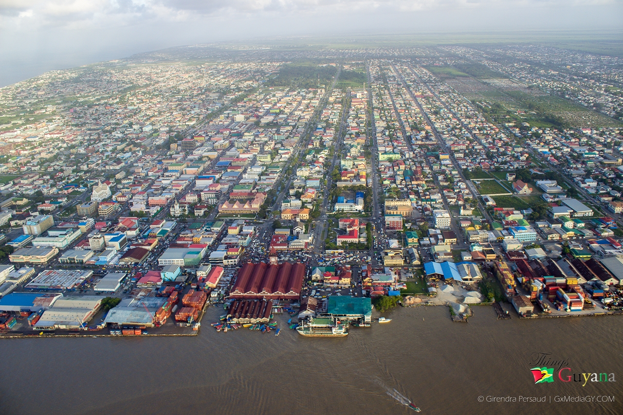
Picture: Georgetown from above.