Barima-Waini is located in the northwestern part of Guyana. It borders the Atlantic Ocean to the north, the region of Pomeroon-Supenaam to the east, the region of Cuyuni-Mazaruni to the south and Venezuela to the west. Barima-Waini covers an area of 20,339 km². The way Region One got its name is quite interesting, the Barima and Waini are actually rivers which give the region its name. These rivers form the border of the region. This region forms part of the forested highland area of Guyana; you can say it is mainly forest-covered. A few roads and trails connect settlements, but rivers serve as the main means of transportation. There are also airstrips which connect the people there to other parts of the country.
-
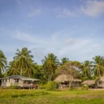
- Shell Beach
-
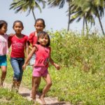
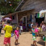
- Children on Shell Beach
-
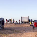
- Boats arriving on Shell Beach
-
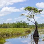
- A Tree in the Waini River
-
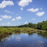
- The Moruca River
-
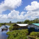
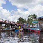
- A Landing on the Waini River
-
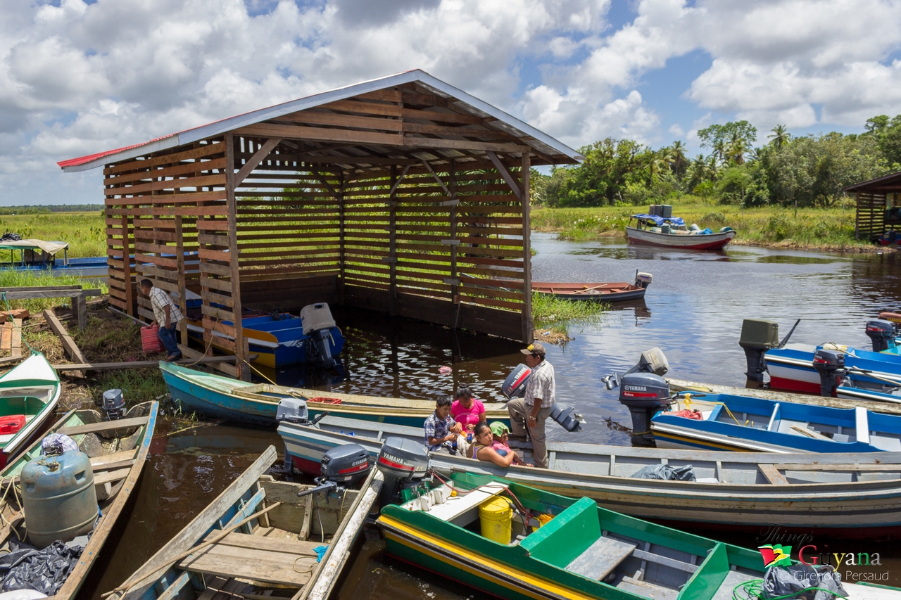
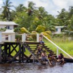
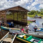
- Santa Rosa Boat Houses
-
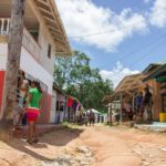
- Santa Rosa Market Area
-
- Santa Rosa Market Area
-
- Santa Rosa – Region 1
-
- Santa Rosa – Region 1
About Region One Barima-Waini
Prior to the 1980 administrative reform in Guyana, the Barima-Waini Region was known as the ‘North West district’. Mabaruma became the administrative centre when it was decided that the former centre, Morawhanna, was too susceptible to flooding. During the late 1960s and early 1970s, serious consideration was once given to moving the capital of Guyana to this area.
Communities In Region One Barima-Waini
There are a number of Amerindian communities in Barima-Waini; they are:
- Acquero (Akwero, Aqueero)
- Arakaka
- Barabina Hill
- Baramani (Baramanna, Baramanni, Barimanni)
- Baramita
- Chinese Landing
- Cummingsburg
- Five Star (Five Star Landing, Five Stars)
- Hobediah
- Hosororo (Hossororo)
- Hotakwai
- Iguapa (Igupa Village)
- Ipotaikuru
- Issororo
- Kaituma
- Kamwatta Hill
- Kariakau (Kariaku)
- Kokerit (Kokerit Landing, Kokerite)
- Konora Village (Konoro Village)
- Koriabo
- Kumaka
- Kwebanna (Kwabanna)
- La Juanita (Juanita)
- Mabaruma (administrative centre)
- Manari (Manari Village)
- Manawarin
- Matthew’s Ridge
- Mission Landing
- Morawhanna
- Moruca
- Mount Everard
- Mubohina
- Pakera
- Parapimai
- Port Kaituma
- Red Hill Settlement
- Saint Bede’s Mission (Saint Bedes)
- Saint Benedict Mission
- Santa Cruz
- Santa Rosa (Santa Rosa Mission)
- Sinclair Landing
- Surprise Hill
- Towakaima (Towakaima Landing, Towokaima Falls)
- Waikerebi Mission
- Waramuri (Waramuri Mission)
- Waropoko Mission
- Wauna-Yarakita (Wauna-Yarikita)
Population Of Region One Barima-Waini
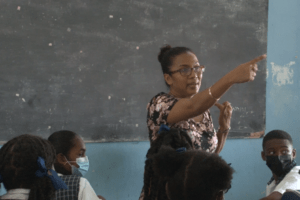
The population of this region consist mainly of Amerindians, many of whom inhabit settlements along the waterways. Two important and fairly populated areas in this region are Matthew’s Ridge and Port Kaituma. In addition to this, Moruca and Santa Rosa Mission are large Amerindian settlements. Other major settlements include Mabaruma (the regional capital), Morawhanna, Towakaima, Koriabo, Hosororo and Arakaka. Barima-Waini has two secondary schools, North West Secondary School in Mabaruma, established in 1965, and Santa Rosa Secondary School, established in 1992. Many of the inhabitants speak their own language, which is Arawak. Some of the elderly residents also speak Spanish because their forefathers came from missions in Venezuela a very long time ago. For this reason, they were called ‘Spanish Arawak’.
Tip: Official census records for the population of Barima-Waini are as follows: Year 2012: Population 26,941; Year 2002: Population 24,275; Year 1991: Population 18,428 and Year 1980: Population 18,329.
Lifestyle Of Persons Residing In Region One Barima-Waini
The main economic activities in the Barima-Waini region are forestry, logging and gold mining. The northern and northeastern sections include thousands of acres of rich alluvial soil, of which its main crops include coffee, ground provisions (such as cassava, eddoes and yams), cabbage, beans, corn, peanuts, and citrus fruits. (This is the area which supplies the famous Pomeroon cassareep).
Did You know? The mineral manganese was once mined in Matthews Ridge and Port Kaituma. However, it was discontinued when falling world prices made it uneconomical to continue.
Places To Visit In Region One Barima-Waini
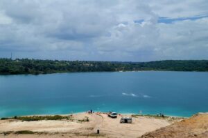
Several beaches are located in this region. The famous ones are known to be nesting grounds for turtles such as Shell Beach. Shell Beach is the only beach in the world where four species of turtle nest during the season from April to August. The world’s largest turtle, “the giant leatherback” nests on this beach. Some other beaches are Almond beach, Luri beach, Turtle beach, Foxes beach, Fathers beach, Iron-punt beach and Pawpaw beach.
Region One Barima-Waini In Guyana
As you would have read, Barima-Waini gets its name from its two main rivers. The region is predominantly forested highland, bordered at the north by a narrow strip of low coastal plain. Very few people live in Region One. There are about 27,643 who live mainly in Amerindian settlements. The administrative centre is in the town of Mabaruma, sub-regional offices are at Port Kaituma and Moruca. There are three hospitals in the region at Mabaruma, Port Kaituma, Pakera near Matthew’s Ridge and Moruca. One of the region’s main economic activities is logging. The largest logging operation is run by the Barama Company, which transports timber to Demerara to be processed into plywood. There are many other timber operations, as the tropical rainforest yields many species of hardwood and other useful types of wood. Mining for gold and diamond is also done in the forested area. Many porknockers set up dredges of various sizes. The coast of Region One is known for its beaches, particularly Shell Beach. One type, the Olive Ridgley, is almost extinct. Another type, the Giant Leatherback, is the world’s largest turtle. The Scarlet Ibis, the national bird of Trinidad and Tobago, is also a common sight on these beaches.
Article References:
- https://en.wikipedia.org/wiki/Barima-Waini
- https://moc.gov.gy/category/region-1/
- https://www.unicef.org/lac/media/4571/file/PDF%20Region%20one%20-%20Barima-Waini.pdf


1 Comment